The Search for MH370
The Search for MH370
by Chris Ashton, Alan Shuster Bruce, Gary Colledge, and Mark Dickinson (all from Inmarsat)
The Journal of Navigation, ©The Royal Institute of Navigation,
22 pages. Published online: 08 Oktober 2014, http://dx.doi.org/10.1017/S037346331400068X
Abstract
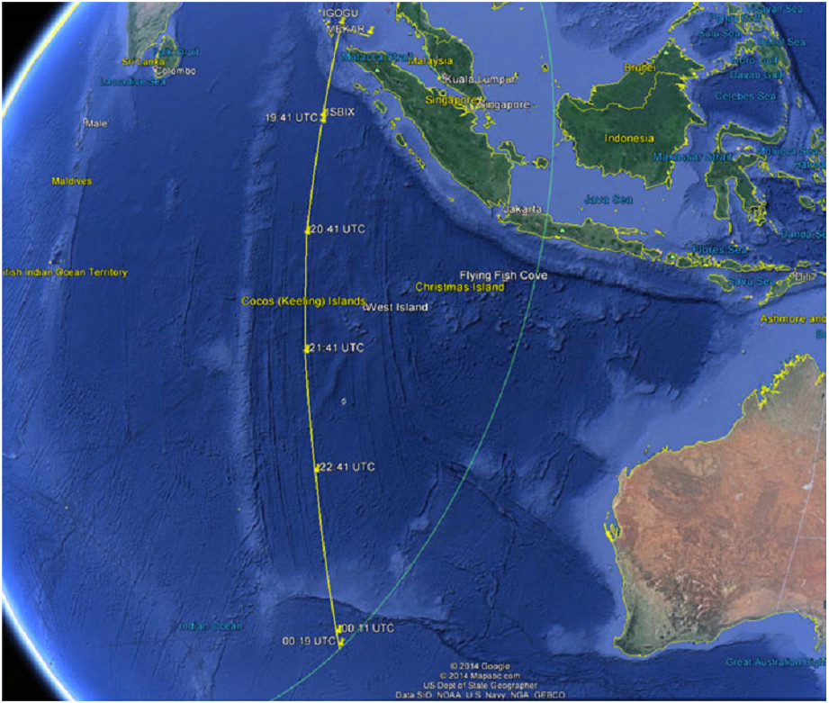
At 17:22 UTC on 7th March 2014 Malaysian Airlinesflight MH370 carrying 239 passengers and crew from Kuala Lumpur to Beijing lost contact with Air Traffic Control and was subsequently reported missing. Over the following days an extensive air and sea search was made around the last reported location of the aircraft in the Gulf of Thailand without success. Subsequent analysis of signals transmitted by the aircraft’s satellite communications terminal to Inmarsat’s 3F1 IndianOceanRegion satellite indicated that the aircraft continued tofly for several hours after loss of contact, resulting in the search moving to the southern Indian Ocean. This paper presents an analysis of the satellite signals that resulted in the change of search area.
CONCLUSIONS. The analysis presented in this paper indicates that MH370 changed course shortly after it passed the Northern tip of Sumatra and travelled in a southerly direction until it ran out of fuel in the southern Indian Ocean west of Australia. A potentialflight path has been reconstructed that is consistent with the satellite data, indicating a last contact location of 34·7°S and 93·0°E, but it is stressed that the sensitivity of the reconstructedflight path to frequency errors is such that there remains significant uncertainty in thefinal location.

